New seismometer network fills knowledge gap in Southland
A new network of seismometers in Southland will fill a seismic blind-spot to uncover any hidden fault lines in the deep south.
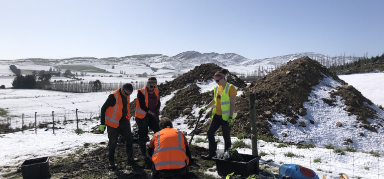
University of Otago researchers, funded by Toka Tū Ake EQC, has started installing seismometers across 19 Southland sites, with the aim of capturing much smaller earthquakes than the existing Geonet network to get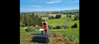 a better understanding of seismic activity and hazard in the region.
“Historically, we think that Southland is a low seismicity area, but the distance between Geonet sensors is over 100km, so a lot of the smaller earthquakes go unrecorded. These new sensors will be roughly 30km apart, which will give us a much better idea of active fault lines in Southland,” says Dr Jack Williams, who leads a large group of researchers, with support of his supervisor Professor Mark Stirling, and Dr Donna Eberhart-Phillips from GNS Science.
Dr Williams says previous seismic activity is often judged by indicators on the surface where land has been uplifted and broken in past earthquakes, but in Southland those indicators may not always tell the full story.
“We can see a lot of scarring in the Central Otago landscape from prehistoric earthquakes because it is dry, but the weather in Southland is very wet, and so the evidence from past earthquakes is removed from the landscape much more quickly,” says Dr Williams who compares the vast plains of the south with the Canterbury landscape before the 2010-11 earthquakes.
“These regions are similar in that we expect there are active faults concealed beneath these plains, but we cannot necessarily identify them from looking at the landscape alone.
“The Canterbury landscape did not give us a lot of clues where the active faults were, but these days you can see land uplifted all over that region. Clearly, the surface may not always tell you what goes on below.”
Dr Williams and his team are funded through the Toka Tū Ake EQC University Research Programme, which is awarded every three years to a number of research agencies around New Zealand to support a variety of natural hazard related projects.
“Toka Tū Ake EQC is proud to enable the important work by Dr Williams, which is a crucial part of the wider research programme by Professor Stirling at the University of Otago in understand low-seismic hazard regions,” says Dr Natalie Balfour, Manager Research at Toka Tū Ake EQC, who adds that applications for the next round of University Research grants opened last week.
“We fund approximately $20m in natural hazard research each year to better understand our natural hazards so we can support communities, local councils and decision makers to be better prepared by making more informed decisions. Finding out more about unknown fault lines in Southland helps us understand less frequently occurring earthquakes so the region can better prepare,” says Dr Balfour.
Similar seismic deployments have greatly improved the understanding of the location and frequency of earthquakes in surrounding regions such as Fiordland and Central Otago, but there is a significant knowledge gap about the upper crust fault lines and seismicity in Southland itself.
“The region also lies at the junction of multiple geological terranes of contrasting materials that may influence where earthquakes occur,” says Dr Williams.
“We will record seismic activity for a full year, which will provide invaluable data to assess the true seismic hazard in Southland.”
The team of researchers will be working closely with a variety of landowners who have agreed to install the sensors on their land and Dr Williams is extremely grateful for the cooperation of all these landowners.
“Without these good people in Southland, this research would be impossible. We are glad they all appreciate the value of this research for their region.”